
Revistas
-
Revista Universidad de Guayaquil
La Revista Universidad de Guayaquil (REVUG), editada por la Universidad de Guayaquil, es una publicación académica de acceso abierto y periodicidad semestral, comprometida con la difusión del conocimiento científico desde 1930. Su propósito es promover la excelencia y la innovación en la investigación, ofreciendo a investigadores, docentes y estudiantes un espacio riguroso y gratuito para la publicación de artículos originales e inéditos, revisados bajo el sistema de evaluación por pares doble ciego.
A partir de febrero de 2024, la revista consolidó una nueva etapa editorial, pasando de un carácter multidisciplinario general a un enfoque interdisciplinario dentro de las Ciencias Sociales, con el fin de fortalecer su identidad académica y alinearse con los estándares internacionales de indexación. Este cambio busca fomentar el diálogo entre disciplinas como Psicología, Economía y Negocios, Educación, Sociología, Derecho, Ciencia Política, y Comunicación, entre otras áreas afines.
Los artículos se publican en español e inglés, con traducción a cargo de la revista, y se encuentran indexados en destacadas bases de datos nacionales e internacionales, fortaleciendo la visibilidad y el impacto de la producción científica.
Actualmente la revista se encuentra indexada en: AmeliCA, Biblat, Latindex Catálogo 2.0, LatinReV, Dialnet, I2OR, MIAR, CiteFactor, LivRe, IndexCopernicus, ADVANCED SCIENCES INDEX (ASI), Open Ukrainian Citation Index (OUCI), Open Academic Journal Index (OAJI), Directory of Research Journals Indexing (DRJI), Eurasian Scientific Journal Index (ESJI), Scilit, Scientific Indexing Services (SIS), ROAD, ResearchBib, Scientific Journal Impact Factor (SJIFactor), ROOTINDEXING, Sherpa/Romeo, Base, Dimensions, Crossref, Google Scholar, OpenAIRE Explore, ISSN.
-
Revista Científica Ciencias Naturales y Ambientales
La Revista Científica de Ciencias Naturales y Ambientales, es una revista científica-académica de acceso abierto de la Facultad de Ciencias Naturales de la Universidad de Guayaquil.
Su objetivo es contribuir a la producción científica, su socialización y debate, en el ámbito de las Ciencias Naturales y Ambientales.
La publicación es semestral en los meses de junio y diciembre. Publica solo artículos de trabajos de investigación, comunicación científica o creación originales.
Dirigida a científicos, docentes y público en general. Código ISSN en línea: 2773-7772, código impreso: 1390-8417 .
Indexada en DOAJ, REDALYC, Latindex 2.0, Base, DOI y Crossref.
-
Revista Ecuatoriana de Ciencias Psicológicas
La Revista Ecuatoriana de Ciencias Psicológicas es una publicación científica de acceso abierto y edición semestral, impulsada por la Facultad de Ciencias Psicológicas de la Universidad de Guayaquil. Su propósito es promover y difundir investigaciones originales, éticas y rigurosas en diversas áreas de la psicología —como la clínica, educativa, organizacional y social— que respondan a las necesidades del contexto ecuatoriano y latinoamericano. Con un compromiso claro hacia la calidad, la equidad epistémica y la transparencia editorial, la revista busca consolidarse como un referente regional en la divulgación del conocimiento psicológico, acogiendo contribuciones tanto teóricas como aplicadas de autores nacionales e internacionales.
-
Investigación, Tecnología e Innovación
Investigación, Tecnología e Innovación es una revista de acceso abierto, revisada por pares, de carácter científico, bilingüe y multidisciplinario.
Su principal objetivo es divulgar los resultados inéditos de investigaciones originales, en las áreas de: 1. Ciencias Naturales: Matemática, Computación y Ciencias de la Información; 2. Ingeniería y Tecnología: Ingeniería Civil, Ingeniería Eléctrica, Electrónica e informática, Ingeniería Mecánica; 4. Ciencias Agrícolas: Agricultura, Silvicultura y Pesca, Biotecnología Agrícola, Otras Ciencias Agrícolas; 5. Ciencias Sociales: Economía y Negocios, Ciencias de la Educación, Derecho, Ciencias Políticas, Periodismo y Comunicaciones; 6. Humanidades, según la Clasificación de Áreas Científicas de la Organización para la Cooperación y el Desarrollo Económicos (OCDE).
A la fecha se encuentra indexada en: LATINDEX Catálogo 2.0, MIAR, DIALNET, LatinRev, REDIB, Index Copernicus, AmeliCA, ERIHPLUS. Investigación, Tecnología e Innovación no cobra por ingreso, procesamiento o publicación de artículos.
Entidad editora: Universidad de Guayaquil, Facultad de Ciencias Matemáticas y Físicas, Ecuador.
Frecuencia de publicación: Semestral (publica el primer número el 31 de mayo y el segundo número el 30 de noviembre).
Correo de contacto: revistaiti@ug.edu.ec -
REVISTA DE LA FACULTAD DE CIENCIAS MÉDICAS
Revista sobre ciencia de la salud de carácter científico de acceso abierto; cuya finalidad es difundir informacion científica en salud y resultados de investigacones para contribuir a la formacion científica del lector.
Dirigido a estudiantes de pregrado, profesionales e investigadores de la salud.
Actualmente se encuentra indexada en las Base de datos: Latindex Catalogo 2.0
-
Revista Científica ESPECIALIDADES ODONTOLÓGICAS UG
La Revista Científica Especialidades Odontológicas UG es un medio digital que tiene por objetivo publicar artículos científicos originales relacionados con el área de las ciencias de la salud.
Está orientada a investigadores, estudiantes y maestros que se dedican al tema de la odontología y aspectos generales de las ciencias de la salud, por lo tanto se difunden artículos de investigación, presentaciones de caso, artículos de oposición y revisiones sistemáticas que promuevan en los lectores el pensamiento crítico y analítico para que amplíen su conocimiento acerca de las ciencias de la salud y la Odontología.
La Revista Científica Especialidades Odontológicas UG es editada y dirigida por la Facultad de Odontología de la Universidad de Guayaquil.
Actualmente la revista se encuentra indexada en las Bases de Datos: DOAJ, Redalyc, Latindex Catálogo 2.0, EBSCO, AmeliCA, OAJI, Periódica, Dialnet, REDIB, MIAR, Google Académico, CrossRef.
-
Revista Minerva
Revista Minerva (ISSN 2953-6316) es una publicación electrónica de carácter científico, es gratuita y de acceso abierto, se dedica a la publicación semestral de artículos resultados de investigaciones originales en español e inglés que abarcan una variedad de temas relacionados con educación y formación docente.
La revista es editada por la Universidad de Guayaquil, Facultad de Filosofía, Letras y Ciencias de la Educación.
El propósito de la revista es difundir resultados de investigación de centros, universidades y entidades dedicadas al desarrollo de la sociedad en general.
La Revista Minerva está dirigida a docentes, investigadores y a la comunidad académica en general.
Indexaciones.
- Latindex Catálogo: https://www.latindex.org/latindex/ficha/27405
- Dialnet: https://dialnet.unirioja.es/servlet/revista?codigo=27685
- ROAD: https://portal.issn.org/resource/ISSN/2953-6316#
-
Artes: Architecture, Technology and Sustainability
ARTES. Revista científica editada por la Facultad de Arquitectura y Urbanismo de la Universidad de Guayaquil, creada en el año 2022.
Está especializada en difundir resultados de investigación científica académica en las áreas de Arquitectura, Urbanismo, Construcción, Historia, Patrimonio, Diseño Interior e Ingeniería abordadas desde diferentes escalas.
Se prioriza la calidad de las colaboraciones, su originalidad, pertinencia temática, sistematización y rigor científico.
Frecuencia de publicación: Semestral, publica el primer número el 30 de Junio, el segundo número el 31 de Diciembre.
-
EASI: Ingeniería y Ciencias Aplicadas en la Industria
EASI: Ingeniería y Ciencias Aplicadas en la Industria presenta un escenario multidisciplinario internacional para investigadores y profesionales de la academia, la industria y el gobierno, para discutir los desafíos sobre la flexibilidad y la interoperabilidad en la industria, además, la relación entre la industria y la sociedad. Publicada desde julio de 2022, manteniendo una regularidad de publicación bianual en los meses “enero y julio”. Nos destacamos por mantener un enfoque de estudio en las áreas de trabajo relacionadas con la interoperabilidad y la industria 4.0, como la Gestión de la cadena de suministro, Automatización industrial, Cyber seguridad en redes industriales, Sistemas físicos cibernéticos, Educación 4.0 en ingeniería entre otras, que, en conjunto ofrecen al autor un abanico de posibilidades en cuanto a la difusión de los resultados de sus investigaciones.
EASI se edita en doble versión: impresa (ISSN: 3073-1526) y electrónica (e-ISSN: 2953-6634), en inglés e identificada con un Digital Object Identifier System (DOI: 10.53591).
EASI está indexada en Latindex, catálogo 2.0, Amelica, LivRe, Periódica, Google Académico, Miar , Dialnet y Road.
-
Scripta Mundi
La Revista Scripta Mundi (ISSN 2960-8031) es una publicación electrónica de carácter científico de la FACULTAD DE CIENCIAS DE LA COMUNICACIÓN SOCIAL (FACSO) DE LA UNIVERSIDAD DE GUAYAQUIL.
Es gratuito y de acceso abierto, solo se reciben artículos originales e inéditos en el campo de la comunicación (periodismo, comunicación visual y audiovisual) diseño gráfico, publicidad. También se reciben investigaciones en ciencias sociales de preferencia que tengan alguna relación con la comunicación; educación, turismo, emprendimiento, innovación y marketing.
Es una revista que publica dos números al año, el primer número en enero, corresponde al primer semestre de enero a junio, mientras que el segundo en julio y corresponde de julio a diciembre.
Está dirigido a investigadores, profesores, estudiantes, profesionales y expertos nacionales o extranjeros en el área de la comunicación y otros campos relacionados.
A la fecha se encuentra indexada en: Latindex 2.0, GoogleScholar, Dialnet, MIAR, Europub. LATINREV. Miembros de la Red de Editores y Revistas Científicas Ecuatorianas (RERCIE)
-
Revista ION-CQ
La revista ION-CQ es un nuevo medio de divulgación científica, humanística, especializada en el área de Ciencias Químicas, creada por el Facultad de Ciencias Químicas de la Universidad de Guayaquil. Esta revista persigue posicionarse en los principales portales de indización, a través de las investigaciones científicas de calidad que se publicaran en ella. Posee un alcance nacional e internacional, y se mantiene abierta a todos los docentes e investigadores.
La revista ION-CQ es una publicación periódica de aparición semestral, en español, aunque se reciben publicaciones en inglés, está arbitrada bajo el sistema de doble ciego; es una revista de acceso abierto. Sus investigaciones están destinadas a dar aportes a la comunidad científica para mejorar la calidad en los procesos, teniendo siempre como objetivo principal la difusión de estudios en los ámbitos de la química, bioquímica, farmacéutica y la salud, con la intención de aportar nuevo conocimiento al acervo científico.
La revista está dirigida a investigadores, docentes, estudiantes y comunidad en general involucrados en los temas de acontecer químico y sus derivados que generen avances científicos sobre estudios en la química y bioquímica. Los artículos recibidos por ION-CQ serán revisados, arbitrados y aceptados, según resultados arrojados por la evaluación para su posterior edición y publicación.
El proceso de edición Enfoques, se encuentra sometido bajos las normas y los estándares de control de calidad, garantizando la originalidad, pertinencia y actualidad de los artículos aceptados y publicados a través del establecimiento de principios de ética y políticas de detención de plagio.
-
Revista de la Facultad de Ciencias Económicas
La Revista de la Facultad de Ciencias Económicas se propone como objetivo contribuir al fortalecimiento y construcción de una nueva identidad en la academia ecuatoriana, constituyéndose como un órgano plural de difusión de la ciencia económica. Para ello invita a profesores, investigadores, estudiantes y profesionales en economía a presentar trabajos de investigación para su eventual publicación.
Desde el 2023 la Revista de la Facultad de Ciencias Económicas se publica de forma semestral, con ediciones disponibles en mayo y noviembre de cada año.
La revista se encuentra indexada en LATINDEX Catálogo 2.0, MIAR, Dialnet, ICI Journals Master List (Index Copernicus), LatinREV, Google Académico.
La convocatoria permanece abierta durante todo el año.
-

RIAF. Revista internacional de actividad física
“RIAF”. Revista internacional de actividad física: Publicación de la Facultad de Educación Física, Deporte y Recreación de la Universidad de Guayaquil, Ecuador.
Revista digital de acceso abierto con arbitraje a doble ciegas con una frecuencia cuatrimestral, que publica artículos originales que presenten rigor científico, solidez teórica y análisis crítico.
El alcance temático abarca las Ciencias de la Actividad Física en General, Educación Física escolar y para la salud, Entrenamiento Deportivo, Actividad Física Terapéutica, Recreación, Deporte, Actividad física FITNES, Ciencias aplicadas a la actividad física y Actividad Física para la salud.
Su público objetivo lo constituyen docentes universitarios, docentes de Educación Física de todos los niveles educativos, entrenadores deportivos, médicos deportivos, nutricionistas, psicólogos deportivos, rehabilitadores físicos, terapeutas e instructores físicos.
Esta revista está indexada en ROAD, Dialnet, LatinRev, Google Scholar, AmeliCA y Latindex Directorio y Latindex Catalogo 2.0 -

Conexiones UG
La Revista Científica Internacional con rigurosidad académica del Decanato de Vinculación con la Sociedad y Bienestar Estudiantil de la Universidad de Guayaquil, Ecuador.
CONEXIONES UG, es una Revista Electrónica de acceso abierto con arbitraje a doble ciego con una frecuencia de publicación semestral, de artículos de alto rigor científico desde una perspectiva transdisciplinaria dirigida al ámbito de comunidades científico-sociales a nivel nacional e internacional.
El objetivo fundamental de la Revista, es difundir temas orientados al impulso científico–social para la resolución de problemas fundamentales de las realidades socioeducativas y comunitarias de distintos niveles socioculturales y económicos, tanto del Ecuador como de los espacios del mundo en los que sea pertinente.
Revista CONEXIONES UG informa que se reciben de manera permanente contribuciones. Todas las contribuciones deben aportar lo siguiente:
Manuscrito sin los datos del(os) autor(es), e Información del manuscrito, y autores.IMPORTANTE: Todas las contribuciones deben ser enviadas a través de esta plataforma web. Caso contrario no se iniciará el proceso de revisión y posterior publicación, si lo amerita.
-

Revista Internacional de Estudios en Ciencias Administrativas STRATEGOS
ISSN:1390-9568 | ISSN-L: 3073-1291
Revista Internacional de Estudios en Ciencias Administrativas STRATEGOS, es una publicación académica de acceso abierto, editada por la Universidad de Guayaquil, que difunde investigaciones originales en las áreas de administración, liderazgo, economía empresarial, contabilidad, finanzas y emprendimiento. Su objetivo es contribuir a la circulación del conocimiento científico generado en el campo de las ciencias administrativas desde una perspectiva crítica y aplicada.
El envío de artículos a la revista implica la aceptación de sus políticas editoriales, éticas y de evaluación. STRATEGOS no cobra tarifas por el envío ni la publicación de artículos, y se rige por los principios del acceso abierto y la divulgación científica sin restricciones económicas para lectores ni autores.
Esta revista publica artículos originales de investigación teórica-aplicada (no estudios de caso, tampoco trabajos descriptivos, exploratorios y/o de alcance correlacional) en idioma español e inglés en los siguientes áreas:
- Contabilidad y Auditoría
- Dirección y Liderazgo
- Economía de la empresa
- Emprendimiento
- Entorno de los negocios
- Finanzas
- Comercio exterior
- Negocios internacionales
- Turismo
- Desarrollo sostenible
-
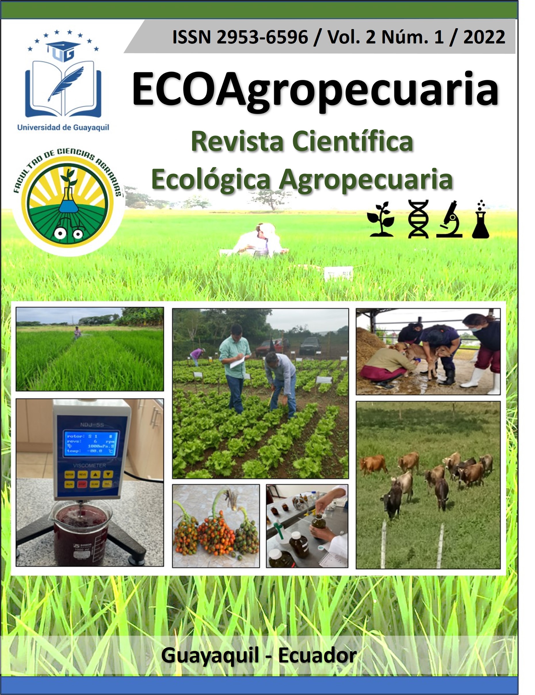
ECOAgropecuaria. Revista Científica Ecológica Agropecuaria
La Revista ECOAgropecuaria es un medio de divulgación científica de acceso abierto y gratuito (no hay costo por procesamiento de artículos), que se publica semestralmente (junio y diciembre), creada por las Facultades de Ciencias Agrarias y Medicina Veterinaria y Zootecnia de la Universidad de Guayaquil.
El objetivo de la revista es publicar artículos científicos inéditos de investigaciones experimentales originales de interés para las comunidades científicas y productores en áreas de las Ciencias Agropecuarias y afines.
Las áreas temáticas que aborda la revista son las siguientes: Ciencias de las plantas, Botánica, Biológicas, Biotecnología Agropecuaria, Recursos Naturales, Ingeniería Ambiental, Agroprocesos, Alimentos y bebidas, Agroeconómica, Química de hidrocoloides y biopolímeros. Ciencias de los animales, salud y producción animal, reproducción, genética y mejora animal, nutrición animal, economía y desarrollo agropecuario, clínica veterinaria y afines.
ISSN DE ENLACE 2953-6596
ISSN DE IMPRESO 3091-1710
Indexado en AMELICA.
-
Derecho Crítico: Revista Jurídica, Ciencias Sociales y Políticas
Derecho Crítico es una revista académica dedicada a la publicación de investigaciones y análisis críticos en el campo del derecho, las ciencias sociales y las ciencias políticas. La revista se enfoca en promover una comprensión profunda y crítica de los problemas jurídicos y sociales contemporáneos, destacando la intersección entre estas disciplinas y su impacto en la sociedad.
La revista está dirigida a académicos, investigadores, profesionales del derecho, estudiantes y todos aquellos interesados en el análisis crítico de las cuestiones jurídicas y sociales. Publica artículos, ensayos, reseñas y estudios de caso que abordan temas relevantes y actuales, fomentando una perspectiva interdisciplinaria y crítica.
Derecho Crítico se destaca por su compromiso con la excelencia académica y la promoción de un discurso crítico y reflexivo, buscando siempre aportar al conocimiento y a la mejora de las prácticas jurídicas y sociales.
Datos de la Revista:
- ISSN-e: 2953-6464
- ISSN: 3091-1664
- Inicio: 2022
- Periodicidad: Semestral
- País: Ecuador
- Idioma: español
- Arbitraje: Revisión por pares doble ciego
-
INQUIDE - Ingeniería Química y Desarrollo
INQUIDE - Ingeniería Química y Desarrollo, es editada por la Facultad de Ingeniería Química de la Universidad de Guayaquil del Ecuador, desde el 2015.
Somos una revista internacional de carácter científico, bilingüe, multidisciplinario y de acceso abierto, publica artículos científicos revisados por pares. Publicamos artículos en inglés y español.Ingeniería Química y Desarrollo, se publica de manera Semestral; el primer número el 1 de enero, el segundo número el 1 de julio; y no se cobra por ingreso, procesamiento o publicación de artículos.
El tiempo de revisión de artículos toma de 1.5 a 3 meses.
Correo electrónico: inquide@ug.edu.ec / francisco.duquea@ug.edu.ec
Objetivo de la revista INQUIDE
La revista INQUIDE – Ingeniería Química y Desarrollo tiene como propósito difundir investigaciones originales, pertinentes y de alto rigor académico que generen nuevos conocimientos teóricos o prácticos en el ámbito de la ciencia y la ingeniería. Se privilegian estudios que contribuyan al avance metodológico, tecnológico o profesional, y que estén alineados con los Objetivos de Desarrollo Sostenible (ODS).INQUIDE – Ingeniería Química y Desarrollo es una revista científica interdisciplinaria dedicada a la publicación de investigaciones originales en ingeniería, ciencia aplicada y desarrollo sostenible. Su enfoque editorial promueve el avance tecnológico, la innovación industrial y la gestión responsable de recursos, en concordancia con los Objetivos de Desarrollo Sostenible (ODS):
-
ODS 7: Energía asequible y no contaminante
-
ODS 9: Industria, innovación e infraestructura
-
ODS 12: Producción y consumo responsables
-
